| Chances are, if you've visited the museum, you've seen the Lentell Map. It is a 14-foot-tall papiermache map of Humboldt County, first constructed in 1915 and updated in 1947. It is one of the most memorable items in the museum and is greatly cherished by visitors. This map, with it's striking appearance, has an incredible story to go along with it! The Lentell Map Known as the Lentell Map, this 14-foot tall, 7 feet 10-inch-wide map was housed at the Humboldt County exhibit during the Panama Pacific International Exposition in San Francisco. The map was constructed by engineer J. N Lentell of Eureka for the Eureka Development Association to display at the Exposition. At the time, maps like these would be made with Plaster of Paris, making the map incredibly hard to transport, especially over the difficult terrain or rough seas from Humboldt County to San Francisco. Lentell instead built the map out of strengthened papier mache, a material that contemporary journalists claimed, “cannot be broken with a hammer”. The map was updated in 1947 to show increasing development of the area, including the new highway and railroads. It has been on permanent exhibit at the Clarke Historical Museum since 1960 and has become a landmark in the museum itself. During events like Arts Alive, locals and visitors alike can be spotted pointing out various location on the map. | 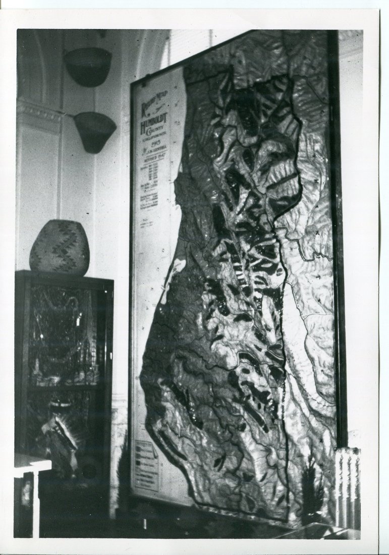 Early photo of the Lentell Map in the Museum Cat #: 2010.003.949 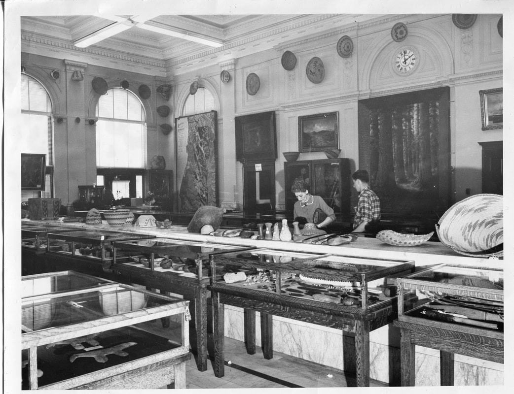 In this photo taken in 1960 around the time the museum first opened to the public, you can see the map in the back corner of the museum. Cat #: 2005.030.948A-B |
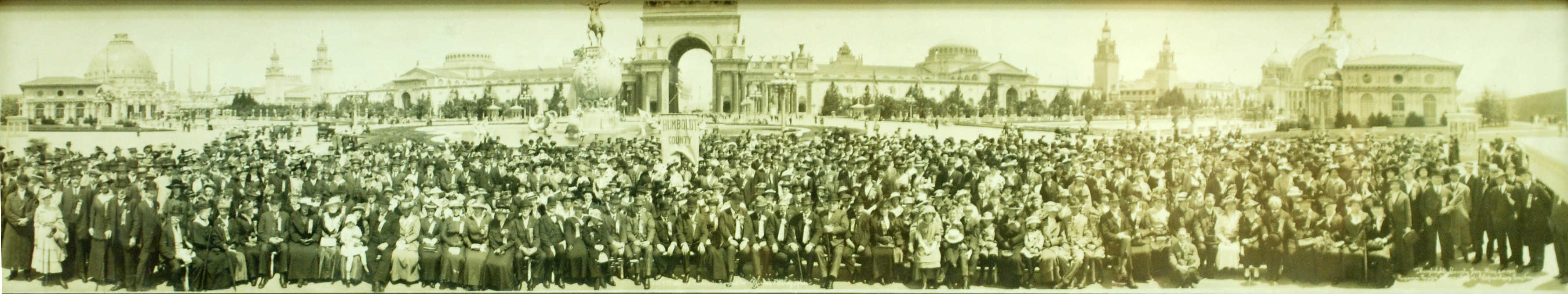
Humboldt County Day, May 24, 1915. 500 Humboldt County Residents descend on the exposition (Cat # 1960.1.8)
Humboldt County and the Panama Pacific International Exposition
In 1915, San Francisco welcomed the world to the Panama Pacific International Exposition. The 600-acre fair was intended to celebrate the opening of the Panama Canal, with a side goal of showing off San Francisco’s earthquake recovery. Expositions like these brought together people from around the country to see a variety of exhibits ranging from cultural to artistic to scientific and promoted technological development. On May 24, 1914, the Exposition welcomed 500 Humboldt County residents who had made the trip to San Francsico with a Humboldt County Day, pictured above.
Besides having its very own day, Humboldt County had its own exhibit at the Exposition. The exhibit was housed in a 20-foot-tall by 20 feet long log and stump house, which you can see part of in the photo below. The redwood building held redwood artwork, examples of local industry, and the Lentell Map. The building was used to promote tourism to Humboldt County ahead of the completion of the Northwestern Pacific Railroad which connected Humboldt to San Francisco at the end of 1914.
Besides having its very own day, Humboldt County had its own exhibit at the Exposition. The exhibit was housed in a 20-foot-tall by 20 feet long log and stump house, which you can see part of in the photo below. The redwood building held redwood artwork, examples of local industry, and the Lentell Map. The building was used to promote tourism to Humboldt County ahead of the completion of the Northwestern Pacific Railroad which connected Humboldt to San Francisco at the end of 1914.
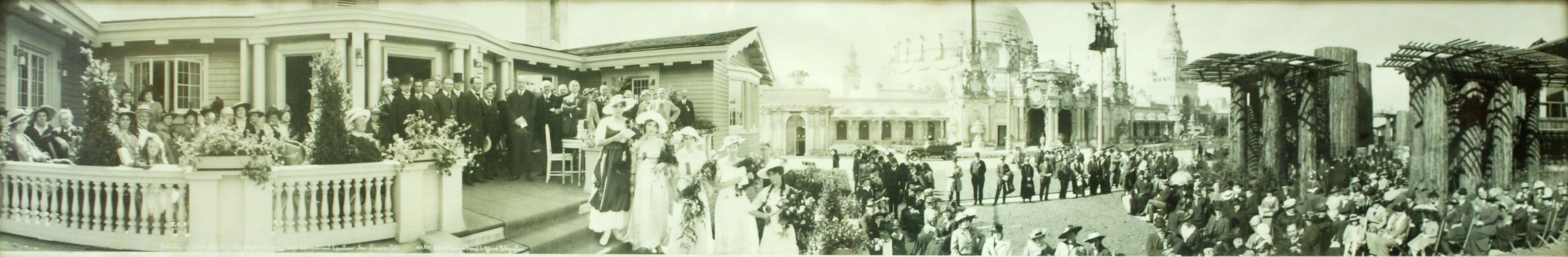
The Dedication of the Redwood Building, 1915 (Cat # 2006.93.175)
Help Restore the Lentell Map!
After years of being on display, the Lentell map is in need of restoration. It will cost $1,100 for professional conservators to restore the map to its original glory. Even the smallest donation will help us care for this fascinating piece of local history. Interested in donating to the cause? Call the museum at 707 443 1947 or email Katie at [email protected] .
 RSS Feed